Making World Geography Fun for Teens with This Atlas Scavenger Hunt
This world atlas scavenger hunt is a great way to add some fun to your middle school geography lesson plans.
In our ever widening global world, it’s crucial that geography be a part of your home school. Luckily, it’s a subject that’s easy to make fun and interactive, especially if you have visual and tactile learners.
You don’t have to spend hours each week on this subject. In fact, if your kids put in 15-20 minutes a couple times a week, they can be well on their way to becoming informed, global citizens.
A perfect place to start is teaching tweens the tools of geography. Think maps, globes and atlases. I’m going to show you a great way to get them engaged as they learn about atlases.

Any links in this post may be affiliate links. See my disclosure statement.
Table of Contents
What is an Atlas
The most simple definition is that an atlas is a collection of maps. However, atlases are much more than just books filled with pages of basic maps.
Besides traditional outline and reference maps, most world atlases also include thematic maps to show population density, topographical data, animals, natural resources, etc. as well as interesting facts about continents and countries.
Our atlases of the United States help compare land formations and natural resources from different regions of the country using a variety of photos and graphics.
Historical atlases can help show changes to country boundaries over time or the movement of troops in battles.
As you can see, they’re much more than a collection of maps.
Two ideas for helping tweens learn how to use an atlas is by letting them create their own and by giving them an atlas scavenger hunt to complete.
Create Your Own Atlas
A project my middle school kids loved from our geography lessons was the creation of their own atlas. As we went through each lesson in this hands-on, comprehensive geography program, my tweens added maps and interesting facts to their personal, one-of-a-kind atlas. We used a three-ring binder for this activity.
By drawing and labeling maps as part of our geography studies, my kids learned the important features of each continent.
This is a great addition to each child’s portfolio and will be a resource they will want to keep for future reference.
Atlas Scavenger Hunt
To help get my kids excited about atlases, I didn’t want to just have them randomly look through one. Instead, I created this fun hands-on activity.
The World Atlas Scavenger Hunt, is an easy way for older kids to learn information about places around the world and become familiar with the format of an atlas.
It contains 26 clues, from A – Z, all related to world geography.
After you download and print off the page, have your kids read the clues and search their atlas for the location that corresponds to each clue. Each one starts with a different letter of the alphabet. Once they know the answer, they should write it in the box next to its first letter.
Don’t pass out the answer key until they’re finished.
Yes, your students can find the answers online, but I highly recommend letting them use a printed atlas because it will help them understand how to navigate through the table of contents, maps, indexes, etc. It’s a wonderful skill for them to build.
You can take the learning a step further by having your teens find each location on a printed map and label it.
Some of the clues include:
- capital of New Zealand
- found in Norway, this is the northernmost city in the world
- the longest river in Africa
- the lowest point in North America
- zero degree longitude
As you can see, it will challenge older kids while they learn a wide variety of fascinating information about the world by scouring their atlas for answers.
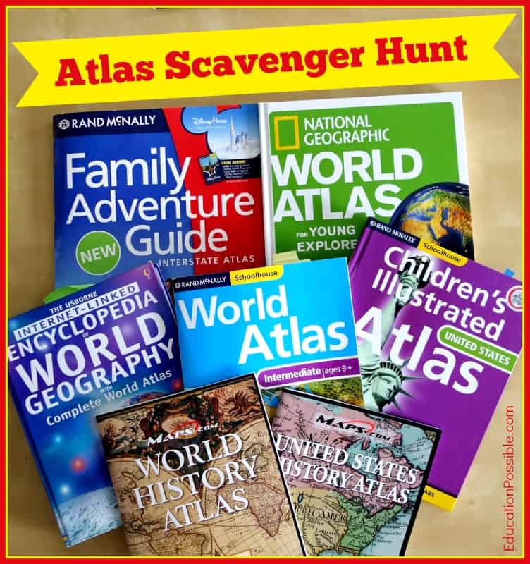
Things you Need to Complete the Atlas Scavenger Hunt
World atlases
Two of our favorites atlases are the Student Atlas from DK Publishing and National Geographic Student Atlas of the World
Printed maps (optional)
We regularly use printable maps in our geography lessons from WonderMaps
I hope that through this World Atlas Scavenger Hunt, your kids will discover how fun and enjoyable it can be learning how to work with atlases.
More Hands-on Geography Activities for Middle School
- 10 Volcano Activities for Middle School
- Latitude & Longitude Scavenger Hunt
- United States Atlas Scavenger Hunt
- Online geography games
- Geography Projects for Middle School
- Flags of the World Matching Game
Helpful Middle & High School U.S.Geography Resources
- North Star Geography Curriculum (the one we used)
- Student Atlas
- WonderMaps
What are you using to teach your teens about using an atlas?
18 Comments
Comments are closed.
What a neat idea! That’s a great way to get used to learning an atlas.
This is a really nice scavenger hunt, thank you! As part of the Challenge A program through CC my 7th grader is learning how to draw and label the entire world. This scavenger hunt is a nice supplement for what we are doing this year! I just pinned it to my CC board.
I love this idea! My 6th grader, especially, would get a kick out of this. Thanks for the inspiration!
Great post! I’m looking forward to seeing the North Star Geography when it becomes available and I am definitely adding the Atlas Scavenger hunt to the World Geography Unit I am preparing for next year after the kiddos finish their State Study?
I love this! 🙂 I am featuring you as one of my favorites from last week’s Hearts for Home Blog Hop. Be sure to stop by and grab an “I’ve been featured” button. 🙂
Fun, we love Geography and I have done scavenger hunts in the past but for more specific locales. love the print out, thank you 🙂